DRONE RTK, ANYWHERE — IN THREE STEPS
No CORS account, no known point, no infrastructure to set up. UAV Mate gets its position from PPP and serves RTK corrections over its own Wi‑Fi. All coordinates in ITRF2020, current epoch.
⬇ Download the printable PDF (v2.1)Before you start
- UAV Mate charged and powered on — green LED is lit.
- A phone, tablet, or laptop to open the console.
- For base setup: your drone and its controller. For GCP work: a survey pole.
- A clear view of the sky.
| Console sign‑in | password uavmate |
| Wi‑Fi hotspot | UAV MATE-<SN> · open — no password |
| Console URL | http://192.168.2.1:8080 |
| NTRIP caster | Port 2101 · Mount RTCM3 · uavmate / uavmate123 |
Set up & placement
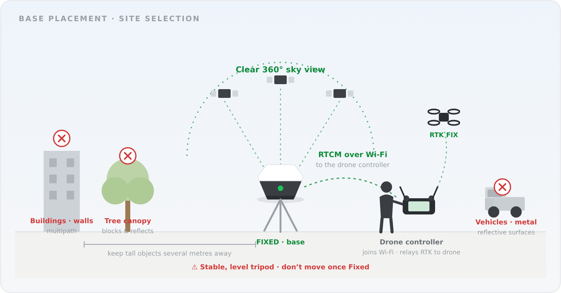
Base — for drone RTK
- Choose open sky with a clear 360° view. Keep away from buildings, trees, vehicles, and metal/reflective surfaces (multipath).
- Mount on a stable, level tripod. Once the base has fixed, do not move it.
- Set up within Wi‑Fi range of the drone's remote controller — the controller joins UAV Mate's Wi‑Fi and relays the corrections up to the drone.
Rover — for GCPs
- Hold the pole vertical over the mark — the built‑in electronic bubble helps you level it.
- Work in the open; avoid tree canopy and tight spots beside walls.
Connect & sign in
- On your phone/tablet, join UAV Mate's Wi‑Fi: UAV MATE‑<SN> (<SN> = your unit's serial number, on the device label). The hotspot is open — no password.
- Open a browser to http://192.168.2.1:8080.
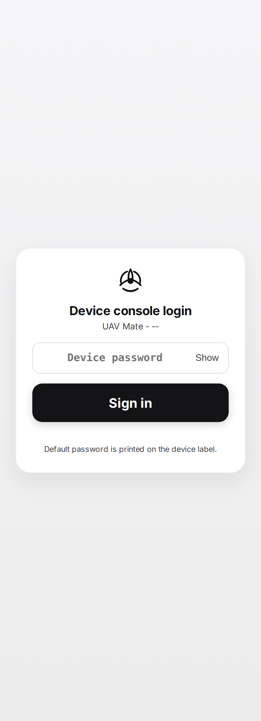
- At the Device console login screen, sign in — default password uavmate.
- The console opens on the Base Station tab. Two tabs — Base Station and GCP Collection — cover the whole workflow; the gear icon opens Device settings.
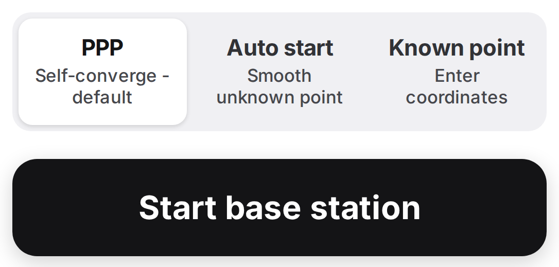
Set up a PPP base station
Choose the start mode & start
Keep PPP (Self‑converge) selected — the default; no known point and no internet are needed. To use a surveyed mark instead, choose Known point and enter its coordinates. Then tap Start base station.
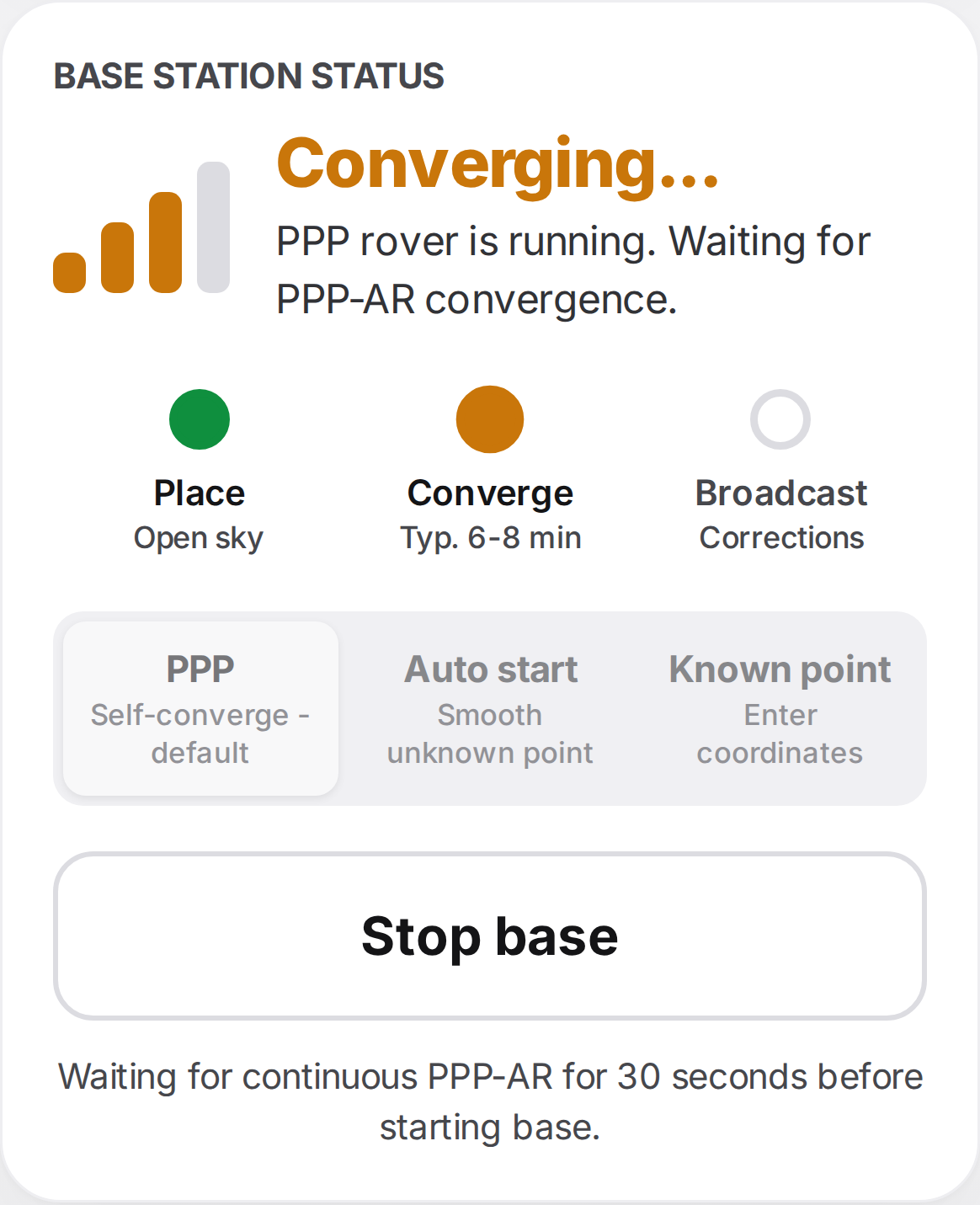
Converge
Keep the unit still. The status card walks through Place → Converge → Broadcast with live progress. Convergence typically takes about 3 minutes under open sky (longer with obstructions) — a good window to set up your drone.
Broadcasting — record the position
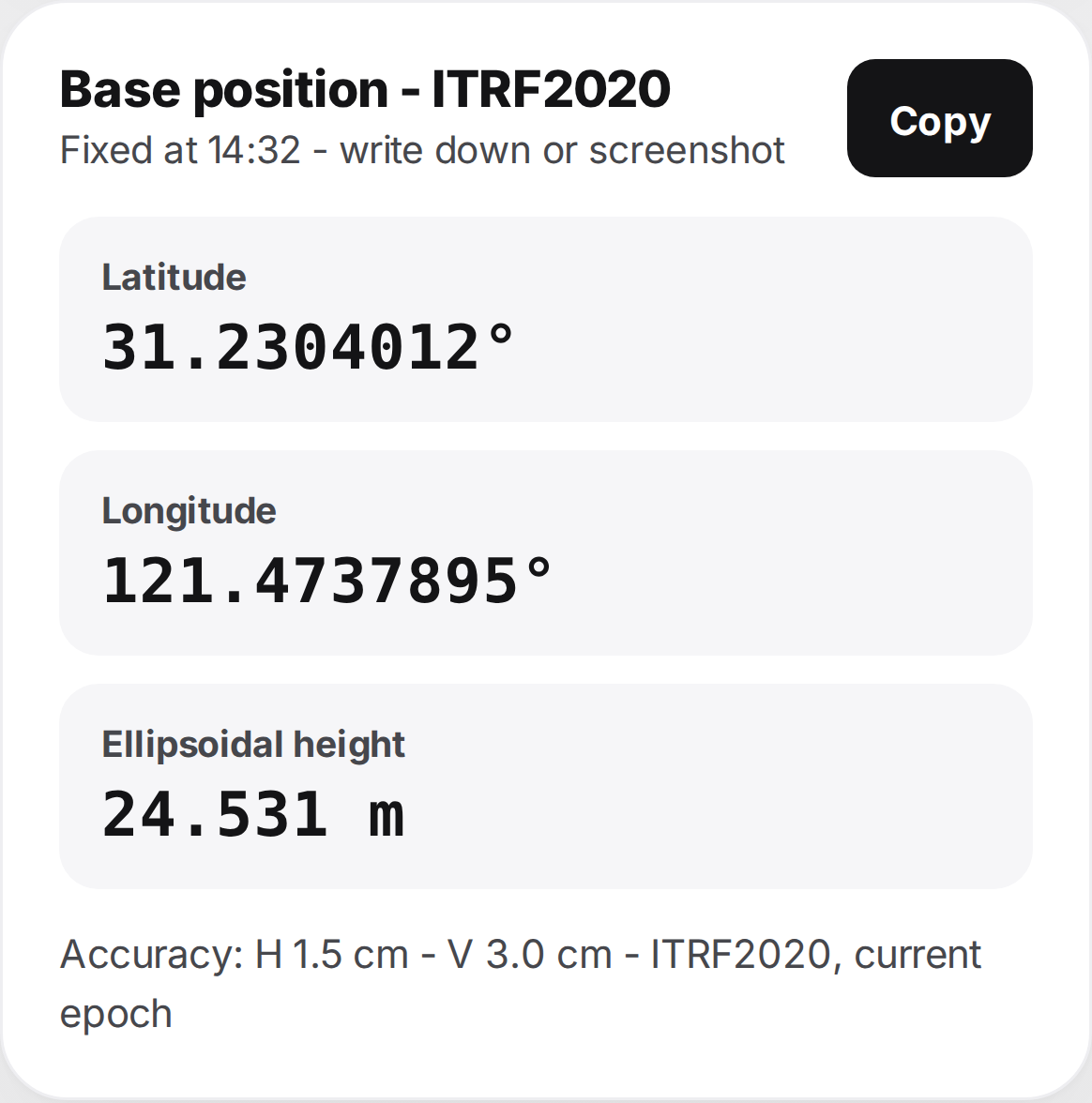
Broadcasting starts automatically once converged — the base sends RTCM corrections over its private Wi‑Fi, and static RINEX logging runs alongside. The fixed base position appears below the status card (ITRF2020, current epoch; typ. H 1.5 cm / V 3.0 cm) — Copy it or write it down for your flight‑planning software.
Connect the drone's controller
The corrections reach the drone through its controller, not the drone directly:
- On the drone controller, join UAV Mate's Wi‑Fi (UAV MATE‑<SN>).
- In the flight app, open NTRIP / RTK and enter:
| Host / IP | 192.168.2.1 |
| Port | 2101 |
| Mountpoint | RTCM3 |
| Username | uavmate |
| Password | uavmate123 |
- Connect and confirm the drone shows RTK Fix. You're ready to fly.
Collect ground control points
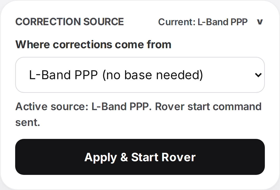
Choose a correction source & start
L‑Band PPP (no base needed) · CORS — your NTRIP account over 4G (SIM required) · Radio — from an external base. Then tap Apply & Start Rover.
Wait for Fixed, then collect
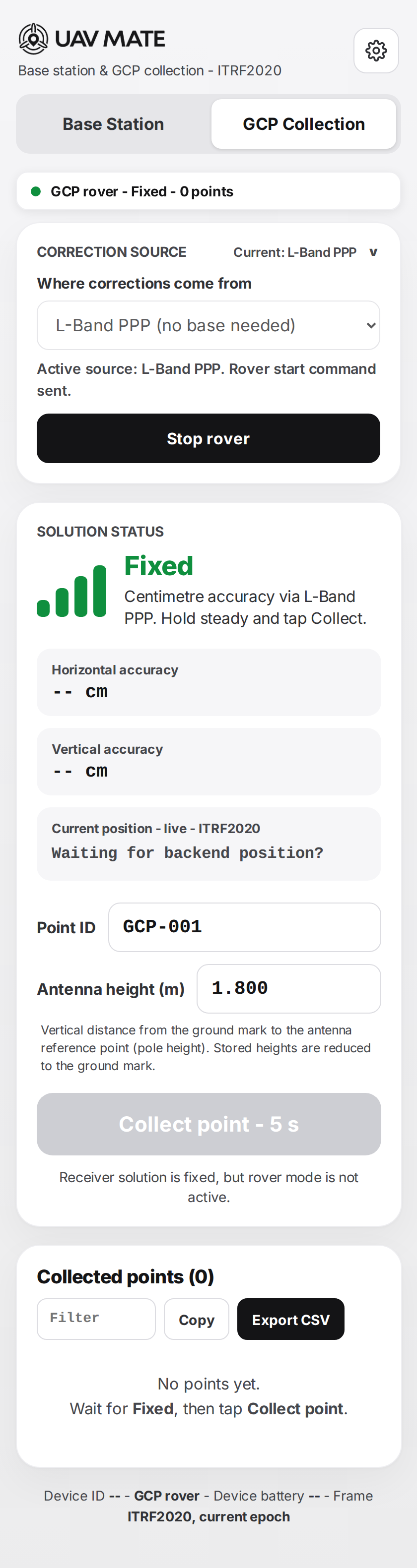
Enter a Point ID and the antenna height (ground mark to antenna reference — stored heights are reduced automatically). When the status shows Fixed, put the pole tip on the mark and tap Collect point — 5 s. Hold the pole steady for the 5‑second occupation.
Export
Repeat for each point, review the Collected points list, then Export CSV.
Read the LEDs
| LED | What it tells you |
|---|---|
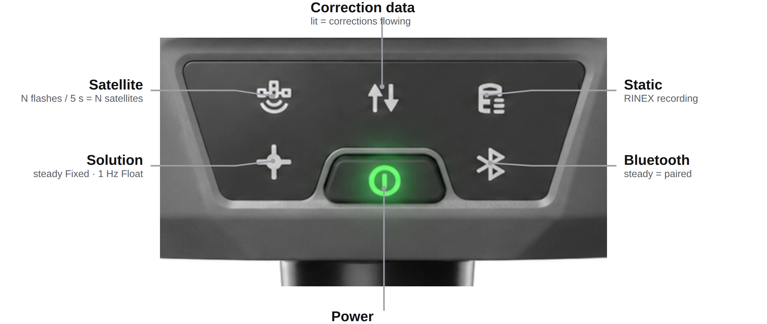
| Satellite | Flashes N times per 5 s = N satellites tracked. |
| Correction data | Lit = receiving / broadcasting corrections. |
| Static | Lit = static raw‑data (RINEX) recording. |
| Solution | Steady = Fixed · flashing 1 Hz = Float · off = no fix. |
| Bluetooth | Steady = paired. |
| Power button | Hold ~2 s = on · hold ~5 s = off. |
| Battery display (bottom) | Each segment ≈ 25 %. Slow flash = 20–10 % · fast flash = < 10 %. |
Solution status — at a glance
| Status | Meaning | Action |
|---|---|---|
| Fixed / Broadcasting | Centimetre, survey‑grade | Good to broadcast / measure / fly |
| Converging / Float | Improving, not yet accurate | Keep still under open sky — wait |
| Single / Acquiring | No corrections yet | Check sky view and the correction source |
| PPP convergence | typ. 3 min |
| PPP positioning accuracy | H 1.5 cm / V 3.0 cm |
| Reference frame | ITRF2020, current epoch |
| Battery runtime | up to 10 h (7000 mAh) |
| Storage · static logging | 8 GB · RINEX 3.x, 1 Hz, max 2 h |
| GCP occupation | 5 s per point · CSV export |
Safety: keep clear of the antenna while the radio transmits (≥ 20 cm for Wi‑Fi/cellular, ≥ 47 cm for UHF) and don't use in a thunderstorm.